
1600s NYC: From Dutch Outpost to English Rule: Tracing the Rise and Birth of a Modern City
The 1600s marked a seminal era in the history of New York City, initiating its transformation from a Dutch settlement, known as New (Nieuw) Amsterdam, to a burgeoning urban center. This period laid the foundation for the city’s expansive future. The establishment of New Amsterdam in 1624 by the Dutch West India Company at the southern tip of Manhattan Island was a critical moment, cementing the city’s strategic significance in trade and commerce.
This century saw the initial urban planning and construction in New Amsterdam, including the creation of the iconic Wall Street, which began as a defensive barrier. The early city plan mirrored the Dutch model of urban development, with well-organized streets and a focus on communal spaces. Despite its early stages, New Amsterdam was notable for its diversity, attracting settlers from various European nations and a meaningful African population.
The 1600s were formative both culturally and economically for the city. The thriving fur trade, boosted by the city’s advantageous port location, was instrumental in its economic growth. The diverse cultural tapestry laid the groundwork for New York City’s enduring legacy as a cultural melting pot. However, this period was not without its challenges, including conflicts with Native American tribes and the English takeover in 1664, leading to the city being renamed New York.
In conclusion, the 1600s were instrumental in shaping New York City’s early character and direction. The advancements in urban design, commerce, and cultural amalgamation during this century set the stage for its transformation into a global metropolis. The legacy of the 1600s remains a vital chapter in New York City’s history, illustrating its beginnings as a Dutch outpost and its journey to becoming a world-renowned urban center.
‘If Mannahatta existed today as it did then, it would be a National Park – it would be the crowning glory of American National Parks.’ — Dr. Eric Sanderson, Mannahatta: The Natural History of New York City
Timeline of New York City’s History 1600’s
Discover surprising historical facts about The City That Never Sleeps—explore fun, educational insights into its history, population, iconic landmarks, and more, perfect for students, history enthusiasts, and anyone curious about NYC’s rich heritage.
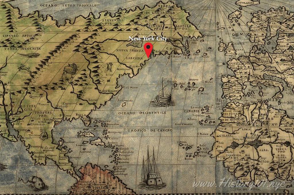
1524: Giovanni da Verrazzano & Henry Hudson: Pioneers of New York's Global City Origins
Discover how explorers Giovanni da Verrazzano and Henry Hudson's early voyages laid the foundation for New York City's as a key hub in the New World
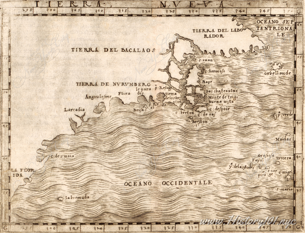
1548: Exploring Giacomo Gastaldi's "Tierra Nueva" Map: A Renaissance Cartographic Gem
Discover the "Tierra Nueva" map by Giacomo Gastaldi, showcasing early depictions of North America's East Coast
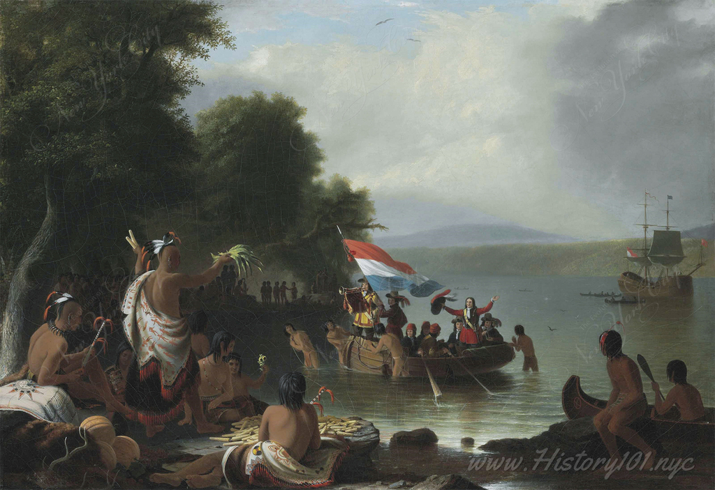
1609: Landing of Henry Hudson at Verplanck Point
Robert Walter Weir's 1835 oil painting "Landing of Henry Hudson, 1609, at Verplanck Point, New York" depicts a pivotal moment in North American exploration.

1624: New Amsterdam to New York: The Commercial Beginning and Its Global Legacy
Explore the transformation of New Amsterdam into New York City, marking the beginning of its journey as a major commercial and cultural hub
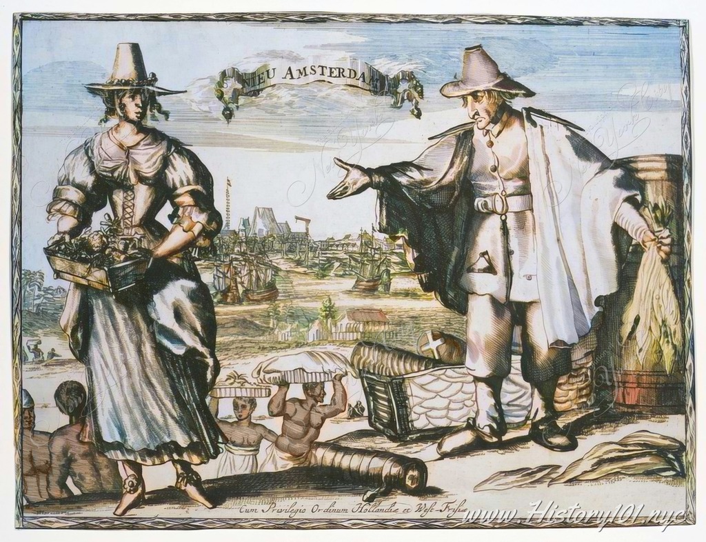
1624: Exploring Deák 032 Engraving: A Glimpse into 17th-Century New Amsterdam
Dive into 17th-century New Amsterdam with the Deák 032 engraving, a vital historical artifact that reveals the early New York City
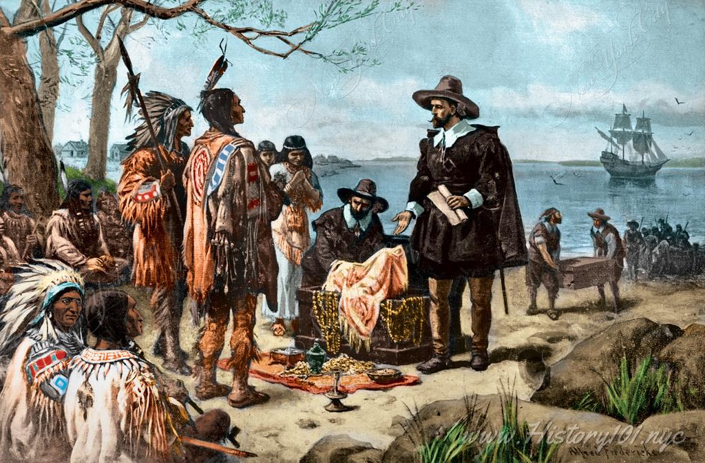
1626: Manhattan Purchase by Peter Minuit: Unraveling the Real Story Behind New York City's Founding
Discover the true 1626 Manhattan purchase by Peter Minuit for 60 guilders, a key moment in Dutch colonial history and New York City's origins
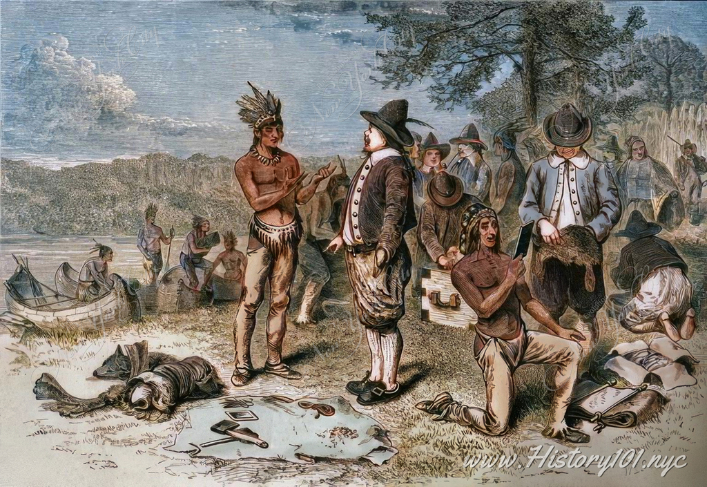
1626: The Dutch and Lenape: Coordinated Trade and Transformation in New Amsterdam
Discover the origins of New York City in 1626 New Amsterdam, where Dutch settlers and Lenape hunters' exchanges laid the foundation for Manhattan, NYC
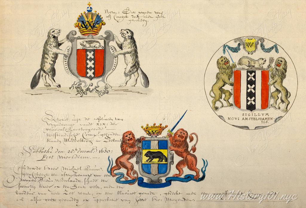
1630: The Coat of Arms of New Netherland: The Economic Foundation of New York City's Seal
Explore the significance of the beaver in the Coat of Arms of New Netherland and its lasting impact on New York's seal, in the 17th-century fur trade
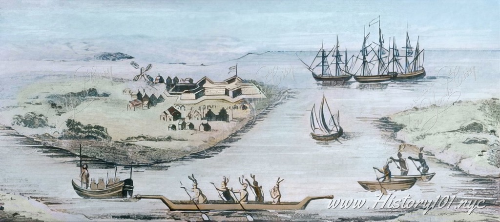
1635: Fort Amsterdam: The Birthplace of New York City - A Historical Insight
Explore the pivotal role of Fort Amsterdam, established in 1623, in the evolution of New Amsterdam into the bustling metropolis of New York City
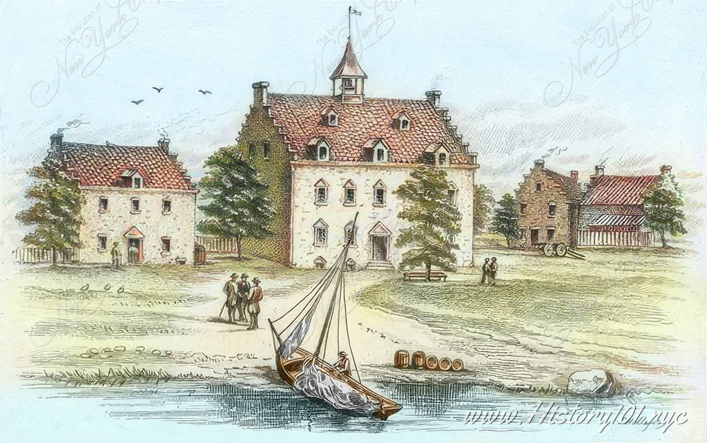
1642: New Amsterdam's First Hotel: Artistic Interpretation vs Historical Accuracy
Explore Samuel Hollyer's engraving of New Amsterdam's 1642 hotel, a historical interpretation rather than a factual depiction of its design
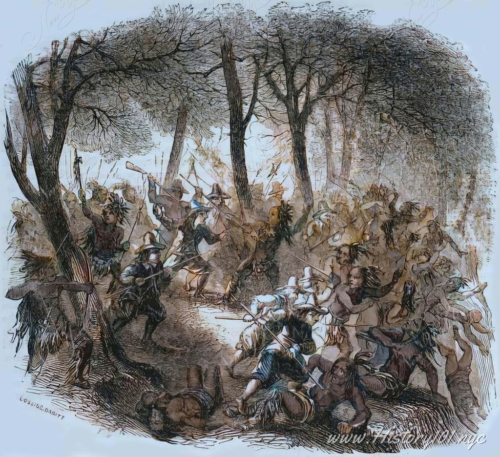
1643: The Pavonia Massacre in Hoboken: A Crucial Turning Point for Dutch and Native American Communities
Explore the Pavonia Massacre's impact in 1643 on New Amsterdam's History, reshaping Dutch-Native relations and policies
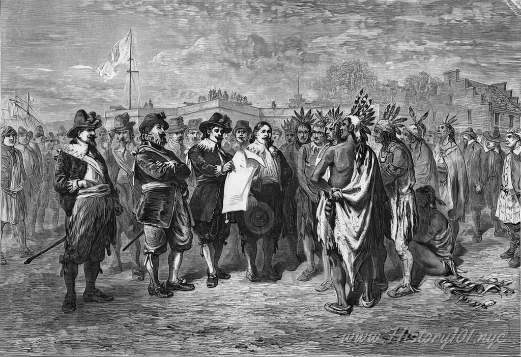
1644: The Dutch-Native American Treaties: Foundation of New York City's Evolution
Explore how Dutch treaties with Native Americans from 1625 to 1664 played a crucial role in the early development of New York City
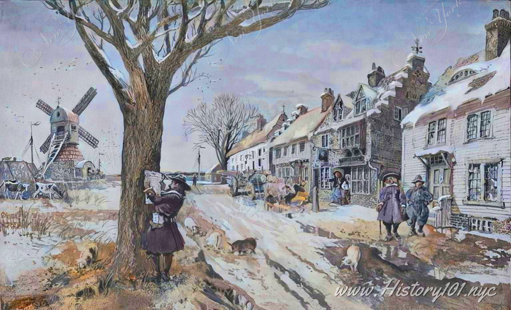
1644: Wall Street's Evolution: From Dutch Defense to Financial Landmark
Explore Wall Street's journey from a 17th-century Dutch defensive wall to a symbol of global financial power in New York City
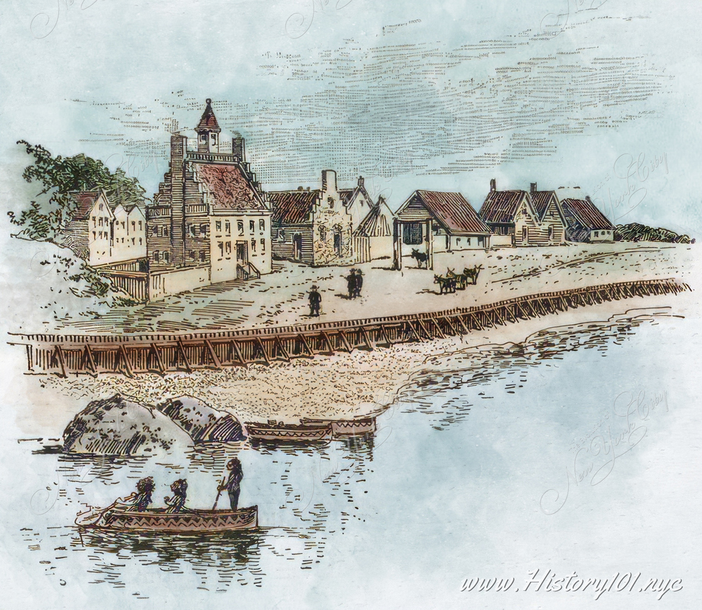
1645: New Amsterdam's Coenties Slip: The Birthplace of New York City's Commerce and Culture
Explore Coenties Slip, the early commercial hub in New Amsterdam, pivotal in the cultural and economic development of what is now New York City
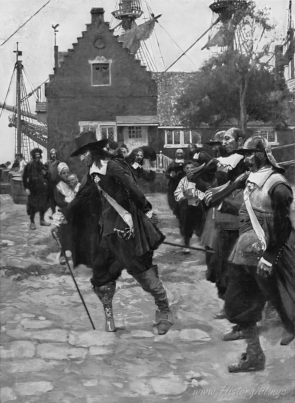
1647: Peter Stuyvesant's Leadership: Transforming New Amsterdam into New York City
Explore how Peter Stuyvesant's governance from 1647 redefined New Amsterdam, setting the foundation for what would become New York City
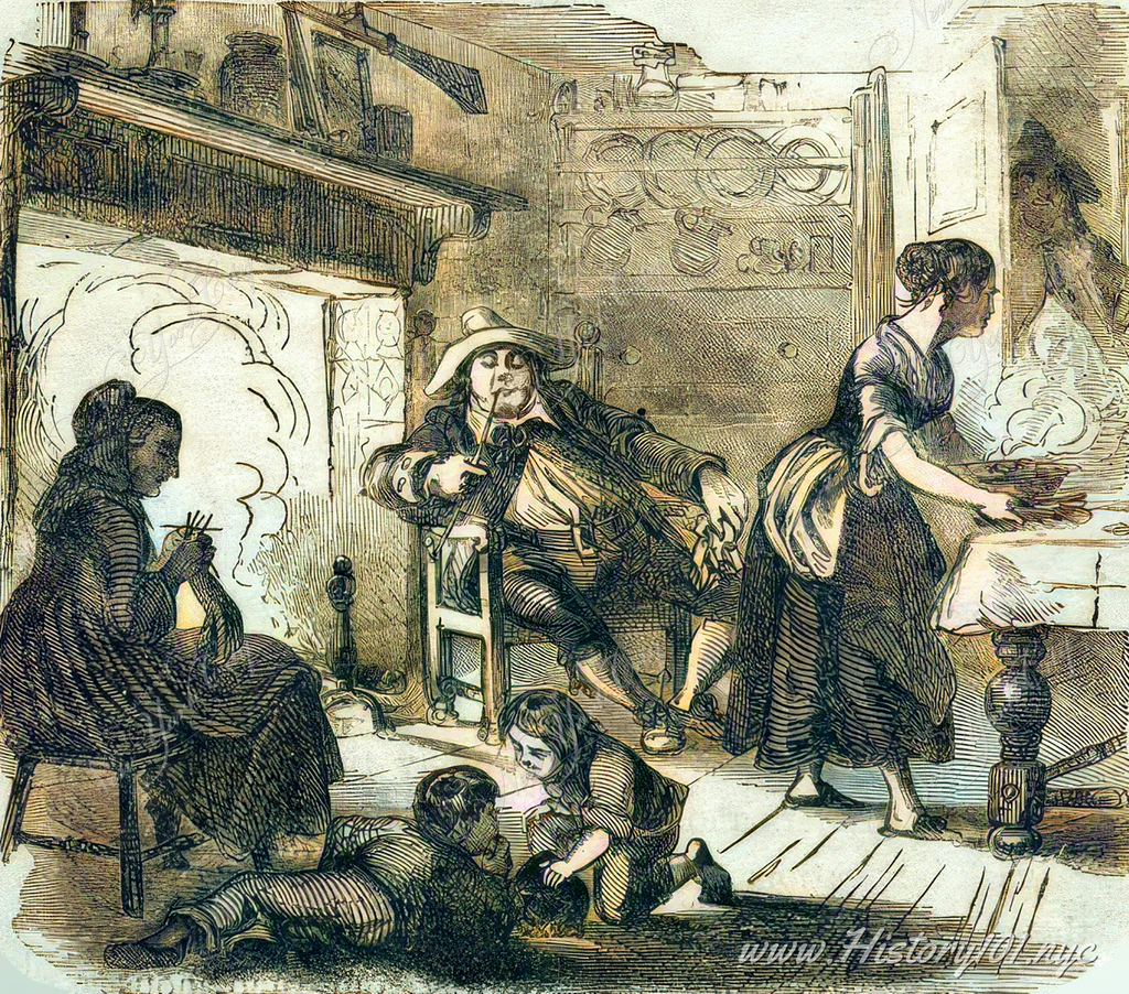
1648: A Glimpse into Dutch Household: Daily Life in New (Nieuw) Amsterdam
Explore the familial and social nuances of 17th-century New Amsterdam, reflecting the customs and values of early Dutch Settlers
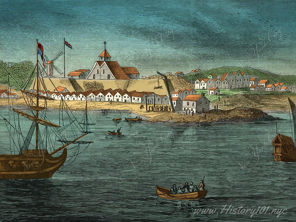
1650: Fort Amsterdam's Impact: A Glimpse into Early New York's Law and Order
Uncover Fort Amsterdam's historical significance in 1650 New York through Arnoldus Montanus' works, including Herrman's vivid illustrations
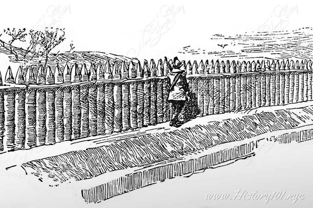
1653: Wall Street Palisade: Dutch Origins of Modern City Planning in NYC
Explore the 1653 Wall Street palisade from New Amsterdam's Dutch settlers in Costello's 1887 book, a key to NYC's urban and defensive roots

1653: Stadt Huys (City Hall) of New Amsterdam: Dutch Legacy in Today's New York City
Explore the pivotal role of Stadt Huys in New Amsterdam's governance and its lasting impact on New York City's evolution from Dutch to British rule

1630: Chronicling New York's Dutch Era in Art: Maxfield Parrish's Art
Discover Maxfield Parrish's 1901 artwork, showcasing the vital Dutch-Native American interactions during New York's formative Knickerbocker era

1659: New Amsterdam's Legacy: The Graft Canal and Fish Bridge in 17th-Century NYC
Explore the transformation of 17th-century New Amsterdam into NYC through the Graft Canal and Fish Bridge, key to the city’s Dutch colonial era
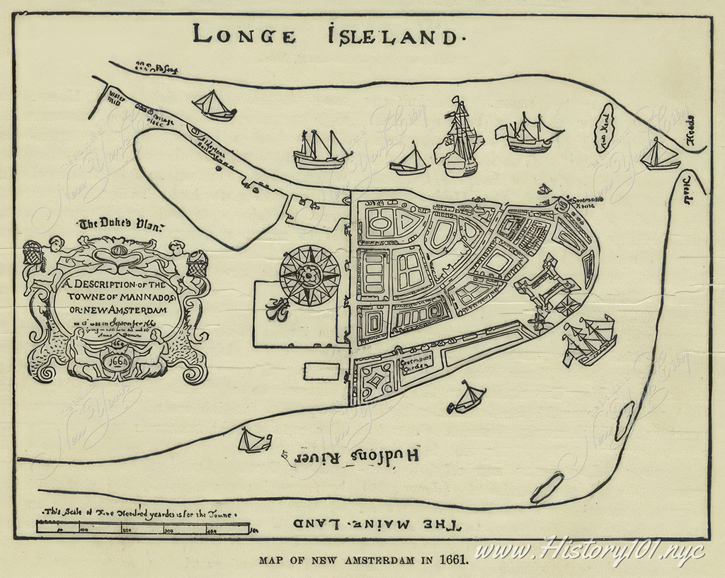
1661: Map of New Amsterdam
This map, known as "The Duke's Plan," provides a detailed depiction of New Amsterdam (present-day Lower Manhattan) as it appeared in September 1661 anda demonstrates the influence the Duke of York held at the time.

1660: The Birth of New York City: Origin of New (Nieuw) Amsterdam on Manhattan Island
Explore the 1624-1660 map of New Amsterdam, tracing NYC's evolution from a Dutch settlement to a global urban hub. Discover historic landmarks

1650: Mural by Karl R. Free: The European Mail's Arrival in New Amsterdam
Explore the significance of Karl R. Free’s mural, depicting the moment European mail reached New Amsterdam, archived by Carol M. Highsmith

1664: The Year New York Emerged from New Amsterdam - A Historic Transition
Discover the pivotal 1664 shift from Dutch New Amsterdam to English New York, a momentous change shaping the city’s legal, social, and cultural fabric

1664: Peter Stuyvesant and Three Men Attempt to Defend New Amsterdam
Illustration of Peter Stuyvesant and three men attempting to defend New Amsterdam from English Invasion

1664: Peter Stuyvesant vs the British
Print shows Peter Stuyvesant with local settlers pleading with him not to open fire on the British who have arrived in warships to claim New Amsterdam for England.

1664: Peter Stuyvesant Surrenders New Amsterdam
Printed illustration shows Dutch soldiers, lead by Director General Peter Stuyvesant, leaving New Amsterdam after ceding it to the English.

1664: New Amsterdam to New York: The City's Pivotal Transformation
Discover the 1664 transition of New Amsterdam to New York, marking a turning point in NYC's history from Dutch to English rule

1667: New Amsterdam Harbor
Illustration of New Amsterdam, a small city on Manhattan Island, New-Holland, North America. The image depicts the harbor and multiple ships taking port.

1664: New Amsterdam to NYC: Unveiling Early City Life Through Heermanns' Art
Explore New Amsterdam's transformation into NYC through Heermanns' copperplate, illustrating the city's 17th-century layout and early societal norms

1673: Old New York Skyline
In the heart of southern Manhattan, the essence of Dutch colonial New Amsterdam is vividly brought to life in this illustration.

1674: The Blockhouse and City Gate
View of the Schoeinge or street piling on the East River shore near present Coenties Slip - the dock and river front to Wall Street

1674: Accurate Map of New Amsterdam
Hugo Allard's "Totius Neobelgii Nova et Accuratissima Tabula," produced around 1674, represents a significant advancement in the cartographic depiction of what is now known as New York City, then referred to as Nieuw Amsterdam.

1679: Dutch Cottage in Old New York
Illustration of a quaint Dutch cottage in a residential section of Manhattan.

1679: The Great Dock in New Amsterdam - Trade, Culture, and Power Shifts
Explore the transformation of 17th-century New Amsterdam into New York, highlighting key events in commerce, slave trade, and colonial rule.

1680: Corner of Exchange Place & Broad Street
Colorized illustration of pedestrians in front of a Dutch-style house, constructed on the north east corner of Exchange Place & Broad Street.

1682: The Great Treaty: William Penn and Lenape's Historic Agreement
Explore the 1682 Treaty of Shackamaxon, where William Penn and Tamanend of the Lenape set a precedent for peaceful settler-Native relations
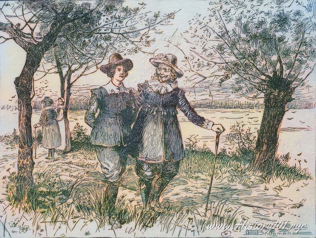
1688: De Perel Straat
An illustration depicts two pairs of figures strolling along the East River, with the shores of Brooklyn and Queens visible in the distance.

1689: The Trainbands Signing Jacob Leisler's Declaration
Print shows English militia members signing an accord which officially established New York under the dominion of the English crown.

1689: Jacob Leisler's Legacy in Shaping New York City's Colonial Era
Explore how Jacob Leisler's influence and residence in colonial New Amsterdam shaped the city's evolution into a key economic and social hub
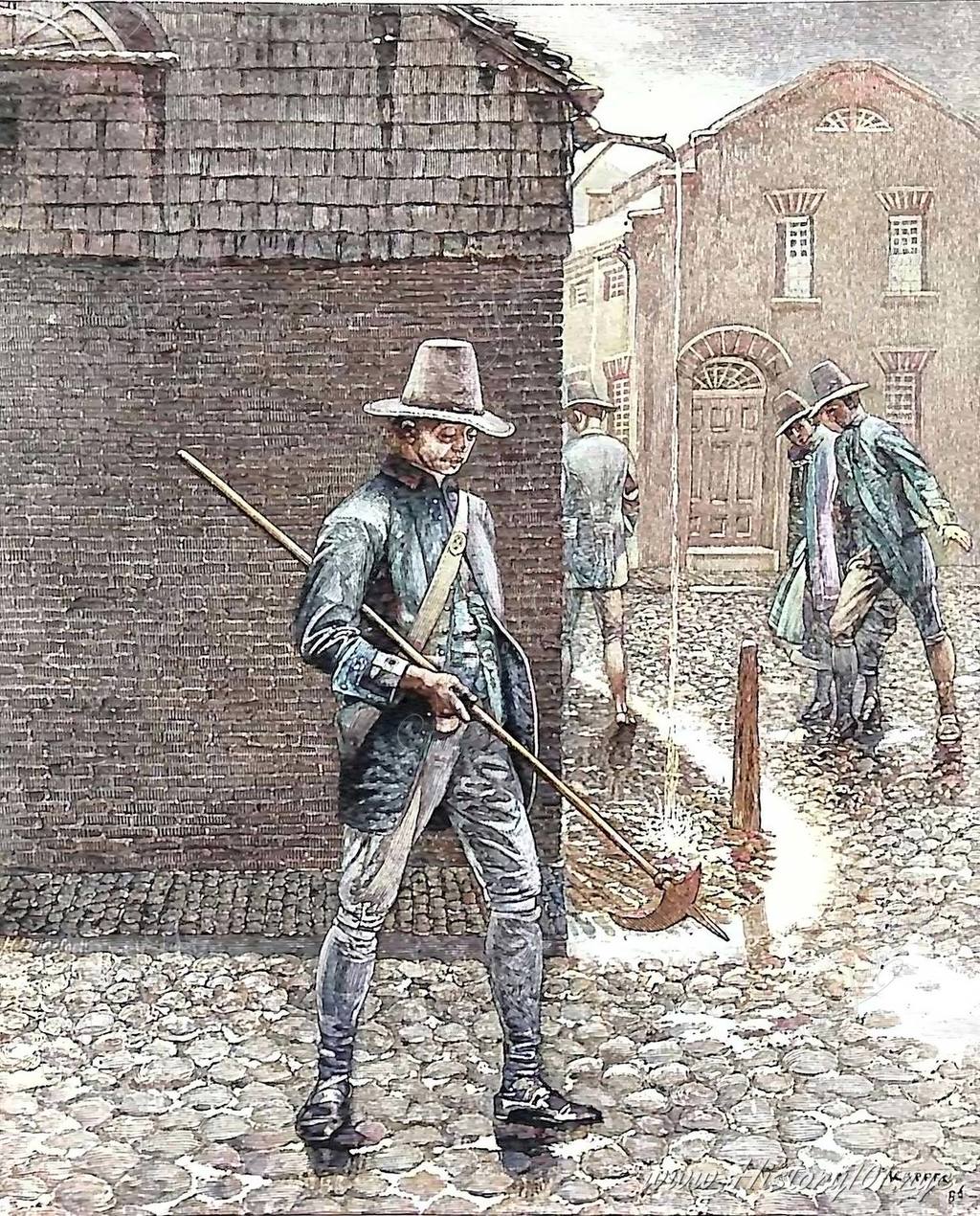
1693: New York Policeman
On a cobblestone street in colonial New York, a lone watchman makes his rounds. This early keeper of the peace, represents one of the first organized attempts at law enforcement in the growing port city.

1696: Captain William Kidd's Odyssey: New York City's Maritime Saga and the Birth of a Pirate Legend
Explore Captain Kidd's 1696 voyage from London to NYC, his ties to the city, and his fateful turn to piracy, shaping New York's maritime history

1699: Pearl Street
Illustration of Pearl Street by the East River with horses and carriages along the road.
Timeline of New York City: 1524-1699
1524: This year marked a significant moment in New York City's history, with Giovanni da Verrazzano, an Italian explorer sponsored by France, entering New York Harbor. He named it "Nouvelle-Angoulême" in honor of King Francis I of France, initiating European awareness of the region. However, this name was eventually replaced by "New York Harbor," following Dutch and English settlement in the 17th century. Verrazzano's voyage played a crucial role in setting the stage for future exploration and settlement of the region.
In tribute to Verrazzano, the Verrazzano-Narrows Bridge was opened on November 21, 1964. It was designed by Othmar Ammann, Leopold Just, and the team at Ammann & Whitney. Spanning the Narrows, this bridge connects New York Bay with the Lower Bay, symbolizing Verrazzano's journey. At the time of its completion, it was the world's longest suspension bridge, representing a fusion of historical significance and engineering excellence, and linking New York's past exploration with its modern landscape.
1525: Portuguese navigator Estevan Gómez, under Spanish commission, launched an expedition to find a northern passage to Asia. His voyage, extending into 1526, led him to explore the northeastern coast of North America. While specifics of his route near future New York City are unrecorded, Gómez's journey significantly contributed to the early mapping of the North American coastline, integral to the Age of Exploration.
Gómez's 1526 exploration is a critical piece of the European maritime exploration narrative, driven by the quest for new routes and territories. His contributions to charting the Atlantic coast advanced geographic knowledge and laid groundwork for future European settlements, including New York City, reflecting the era's expansive exploration endeavors.
1609: Henry Hudson's exploration aboard the Dutch East India Company's Halve Maen (Half Moon) led him to New York Harbor on September 11. This pivotal journey, aimed at finding a northwest passage to Asia, extended to present-day Albany and included early European-Native American interactions. Hudson's expedition catalyzed Dutch interest, culminating in the creation of New Amsterdam, which later became New York City. His discovery highlighted the area's strategic value, setting New York City's course as a key trading and settlement hub.
Hudson's 1609 voyage profoundly influenced New York City's evolution. By charting the Hudson River and engaging with local tribes, he initiated European presence and settlement in the region. This laid New Amsterdam's groundwork, shaping New York City into a significant commercial center. His journey marked the start of a rich cultural and historical tapestry, blending European exploration with the city's eventual urban and economic growth.
1610: The Hudson Valley witnessed a pivotal shift with the arrival of Dutch traders, following Henry Hudson's 1609 exploration. While Hudson, employed by the Dutch East India Company, didn't find a northeastern passage to Asia, his journey unveiled the Hudson River's potential. The Dutch capitalized on this, engaging primarily in the fur trade with Native Americans. Their commercial activities extended from the Hudson River's mouth to the Mohawk River and even towards the Delaware River, with a focus on trade rather than settlement.
This initial Dutch engagement in the Hudson Valley from 1610 significantly shaped New York City's future. It marked the beginning of European influence in the region, eventually leading to the establishment of New Amsterdam, the future New York City. The Dutch focus on fur trading with indigenous populations laid the foundation for New York City's development into a major commercial hub. This early period was crucial in defining the city's economic and cultural landscape, positioning it as an important center in the New World.
1613: Dutch explorer Adriaen Block embarked on a momentous voyage, significantly influencing the early exploration of the New York region. Navigating the Hudson and East Rivers, he discovered Hell Gate and explored the Long Island Sound and Connecticut River, notably naming Block Island. His exploration extended to Massachusetts, passing near future Boston, illustrating the expansive nature of his journey.
Simultaneously, Cornelius May, another Dutch explorer, charted the southern shores of Long Island and ventured into Delaware Bay, reaching the Schuylkill River's mouth. These 1613 explorations by Block and May were pivotal, mapping the coastal areas key to New York City's future development and Dutch settlement. Their journeys marked the start of comprehensive geographical understanding of the region, crucial for subsequent settlement and growth.
1613: Juan Rodriguez, also known as Jan Rodrigues, stands as a seminal figure in the tapestry of Manhattan's early history. Arriving as one of the earliest, if not the first, non-Native settlers, his diverse heritage — encompassing African, European, and possibly Native American roots — embodies the multicultural foundation of what was then New Amsterdam. His role as an early merchant had a profound impact on the burgeoning local economy, marking him as a pivotal player in the commercial and cultural development of the area.
Juan's legacy in Manhattan transcends his time, reflecting a mosaic of cultural identities that prefigured the modern, diverse ethos of New York City. Celebrated along a significant corridor of Broadway, from 159th Street to 218th Street, Juan Rodriguez Way serves as a lasting homage to his contributions. This dedication not only acknowledges his role as a foundational non-Native settler, but also honors his enduring influence on the historical and cultural narrative of New York City.
1614: A pivotal year in the evolution of Manhattan Island and its surroundings. Dutch settlers, backed by the New Netherland Company’s monopoly on the fur trade, established a significant presence. The company focused on the area between the 40th and 45th parallels, recognizing the Hudson River’s strategic value. They built Fort Nassau near modern-day Albany, primarily as a trading post, engaging in peaceful trade with local Iroquois groups.
That year, a Dutch trader also established a small trading post on Manhattan Island, then inhabited by the Manhattan Indians. However, the early Dutch ventures faced challenges, exemplified in 1617 when Fort Nassau was destroyed by a spring flood. This event signified the end of this initial phase of Dutch exploration and trade, setting the stage for further development in the region.
1618: A turning point in New Netherland’s history when the States General chose not to renew the New Netherland Company's charter, ending its fur trade monopoly. This decision coincided with the company’s strategic treaty with the Iroquois, aimed at countering French influence in North America. This alliance made the Iroquois a buffer against French expansion, crucially impacting the geopolitical dynamics of the region, particularly in the Mohawk and Hudson Valleys.
The end of the company’s charter ushered in an era of free trade, attracting diverse European traders to engage with Native American populations. This shift led to increased European and indigenous interactions, enriching the economic and cultural fabric of New Netherland. This period of open commerce and expanded interactions set the foundation for future expansion and development, profoundly shaping the region's future.
1621: The Dutch West India Company (WIC) was chartered, profoundly impacting New Netherland's history. This move was motivated by desires to tap into the Americas' and West Africa's resources and to challenge Spanish commerce, amidst the Netherlands-Spain conflict in the Eighty Years' War. The WIC, granted monopoly over New Netherland, managed the region's governance and resources, notably fur trade, and participated in the transatlantic slave trade.
The WIC's formidable naval fleet, comprising warships, armed sloops, and merchant vessels, played a critical role in Dutch expansion. This fleet was key in both safeguarding Dutch Atlantic interests and engaging in military actions against Spanish and Portuguese territories. The Dutch West India Company's establishment marked a significant phase in Dutch history, intertwining economic ambition with geopolitical strategy, and shaping New Netherland's development.
1624: New Amsterdam, destined to become New York City, welcomed its first Dutch settlers. These pioneers, including Protestant Walloons escaping persecution, began constructing key infrastructure and forging relations with the Lenape tribe. Their arrival initiated the city's multicultural foundation, setting the stage for its diverse and dynamic future.
Initially led by Willem Verhulst, not Cornelius Jacobsen Mey, the settlement flourished in areas like Fort Orange (near present-day Albany) and along the Delaware River. Verhulst's tenure ended in 1625 when Peter Minuit took over, marking a significant transition in leadership. This era was crucial in shaping New Amsterdam's early development, leading to its transformation into a major urban center under Dutch rule.
1625: The Dutch West India Company began constructing Fort Amsterdam, located in present-day Battery Park, New York City. Built to protect New Amsterdam against potential threats, including English forces and Native American tribes, its strategic position near both the Hudson and East Rivers was key for defense and maritime activities. The fort quickly became a central site for defense and trade, especially the lucrative fur trade.
Fort Amsterdam's establishment was pivotal in New Amsterdam's evolution into a major port. Serving as a symbol of Dutch power and a hub for commerce, it significantly influenced the region's development. This fort laid the groundwork for what would become a globally significant port, a legacy that continues to resonate, highlighting the enduring impact of Fort Amsterdam on global trade and maritime history.
1626: Peter Minuit, a Dutch governor, acquired Manhattan for trade goods valued at 60 guilders, equivalent to about $1,150 today. This transaction, recorded by Peter Schaghen, highlights the differing perspectives on land ownership between the Dutch and the Lenape. The Lenape seemingly perceived the agreement as a grant for shared land use rather than an outright transfer.
This crucial point in New York City's early history was a significant milestone in Dutch settlement, leading to the establishment of New Amsterdam. This development laid the groundwork for modern New York City and was a notable contribution to the narrative of the Americas. This pivotal event in NYC's rich history underscores the dynamic interplay of cultures and marks the beginning of the city's evolution into a global metropolis.
1626: The Dutch West India Company brought the first Africans to New Netherland for labor, marking the onset of African presence in present-day New York. Unlike the later Southern chattel slavery, these Africans were part of an indentured servitude-like system with limited rights under "half-freedom." They played a vital role in development, constructing infrastructure and farming. This era in New Netherland was characterized by a blend of servitude and restricted autonomy, distinct from the harsher slavery systems that followed.
The shift towards stricter slavery laws emerged after 1664 when the English took control, renaming the settlement New York. English laws introduced more rigid slavery norms, drastically altering the legal status and treatment of African people. Under Dutch rule, some had land rights and limited freedom, but these were rare exceptions. The period under Dutch influence thus reflects the complex evolution of labor, rights, and racial dynamics in early North America, laying groundwork for the intricate history of slavery and freedom in the region.
1626: Established circa 1626, Whitehall Street is among New York City's oldest, originating from the Dutch settlement of New Amsterdam. Initially, the street had different names for its sections: the north was Markvelt or Marckvelt, others were Beurs Straat, Waterside, and Lang Straat. By the 1640s, Whitehall Street gained prominence through land grants to settlers. A notable development was the construction of the Governor's House by Peter Stuyvesant around 1657 at today's Pearl and Whitehall intersection. Post the 1664 British takeover, this building was named "Whitehall," akin to London's governmental seat.
By 1676, Whitehall Street had twelve significant residences. The British added the Whitehall Battery at its southern end under Governor Edmund Andros. The street also featured "De Riemer's Well" near Bridge Street. The street's name evolution, finalized as "Whitehall Street" by 1731, illustrates the shift from Dutch to British control, marking its historical significance in New York City's evolution.
1628: The inaugural church in Fort Amsterdam, now Lower Manhattan, was established, signifying a key chapter in New York City's early history. This construction within the Dutch community of New Netherland's administrative center marked the onset of structured religious practices and was central to the cultural and spiritual lives of early settlers. It represented the early European influence on the region's religious development.
More than a place of worship, this church served as a community hub, fostering unity among settlers. It set the stage for the evolution of religious institutions in the growing city, shaping its diverse religious heritage. The church's establishment within Fort Amsterdam highlights the profound impact of religion on the daily life, laying a foundation for New York City's rich religious landscape.
1629: The Dutch West India Company introduced the "Charter of Privileges and Exemptions" in New Netherland to boost settlement. This charter launched the patroon system, offering large land grants to encourage relocation to the New World. Patroons, given extensive control over lands up to 16 miles along navigable rivers, were tasked with settling at least 50 adults within four years. This system attracted company directors and wealthy Dutch individuals, leading to substantial land claims, especially in the Hudson Valley.
Kiliaen Van Rensselaer, a notable patroon, established Rensselaerswyck near modern-day Albany. He expanded his holdings by purchasing additional lands from Native Americans. Tenants on these estates, operating under a semi-feudal structure, paid crop rents and relied on patroons for justice and administration. This unique blend of European feudalism significantly influenced the region’s social and economic landscape.
1631: New Netherland's patroonship system, precursory to New York City's settlement, faced significant challenges. The Dutch West India Company's initiative allowed patroons to own vast lands, provided they settled 50 people within four years. However, restrictive tenant conditions, contrasting with more favorable English land-ownership opportunities across the Hudson, lessened its appeal.
The company, acknowledging these setbacks, sought to revise the system to entice settlers, but specific amendment dates remain undocumented. This decline in the patroon system's allure played a key role in shaping early settlement trends in the area, pivotal to New York City's evolution.
1632: Dutch settler David Pieterszoon de Vries founded Zwaanendael, now Lewes, Delaware, extending Dutch influence in North America. With about 30 families, he initiated farming and built fortifications for the community, leaving Capt. Pieter Heyes in charge while he returned to Holland.
However, Zwaanendael met a tragic fate that same year. In de Vries's absence, conflict with local Native Americans culminated in an attack, destroying the settlement and killing most settlers, including Heyes. This event marked a significant setback in Dutch expansion efforts, highlighting the perils of settlement in that era.
1632: New Netherland witnessed a significant change with the Dutch West India Company recalling Director-General Peter Minuit. Known for acquiring Manhattan in 1626, Minuit's removal stemmed from disputes over his administrative methods, particularly allegations of private trading, which contradicted the company's monopoly policies.
Minuit's recall marked a turning point in New Netherland's history, instigating a shift in leadership. Disagreements over his management, especially trade practices and interactions with Native Americans, impacted the community's profitability and his relationship with the company. This led to the end of his directorship and the beginning of a new administrative era in 1632.
1633: Wouter Van Twiller succeeded Peter Minuit as Director-General of New Netherland, a move by the Dutch West India Company to bolster management. Van Twiller, related to influential patroon Kiliaen Van Rensselaer, led until 1637 amid various challenges.
Van Twiller's administration was criticized for ineffectiveness and indecision, grappling with community affairs, neighboring English settlements, and Native American relations. However, his tenure also witnessed territorial and infrastructural expansion. His mixed legacy embodies the complexities and trials of early Dutch governance in North America.
1636: Between 1636 and 1638, Wouter van Twiller, governor of New Amsterdam, secured a landmark deal with the Lenape Native Americans, acquiring approximately three thousand acres in present-day Brooklyn, including Gowanus and areas north and west of Jamaica Bay. This significant expansion of New Amsterdam's territory laid the groundwork for Brooklyn's development, an integral part of modern New York City.
This land acquisition catalyzed Dutch settlement and agricultural growth, pivotal in shaping Brooklyn's economic and demographic landscape. Van Twiller's initiative reflects the era's complex dynamics between European settlers and Native Americans, playing a critical role in New York City's historical narrative and its evolution during North America's Dutch period.
1637: William Kieft became Director-General of New Netherland, succeeding Wouter Van Twiller. His tenure until 1646 was tumultuous, highlighted by Kieft's War (1643-1645), a destructive conflict with local Native American tribes. Kieft also faced challenges from English settlers encroaching into areas like Connecticut, creating a tense atmosphere.
Prior to Kieft, the Dutch secured a foothold in the Connecticut River Valley, establishing Fort Good Hope in 1633 after acquiring land from the Pequot tribe. However, English settlers, starting with Plymouth's founding of Windsor in 1633, contested Dutch claims. Massachusetts settlers' relocation to the Connecticut Valley in 1635 escalated tensions, which were further strained during Kieft's governance, as he strove to uphold Dutch dominance in these disputed territories.
1638: Established around 1638, Marketfield Street in Manhattan's Financial District traces back to New Amsterdam's Dutch era. Originally Marcktveldt, it led to a vital livestock market near today's Battery Park, operating from 1638 to 1647, with the first cattle market opened by Governor-General Willem Kieft in 1641. This street, essential to early commerce, underwent several name changes including Exchange Street and Petticoat Lane, reflecting its dynamic role in the city's growth.
By 1680, Marketfield Street had evolved into a residential area for the less affluent. Its historical journey continued in 1688 with the establishment of New York City's first French Huguenot church, symbolizing the area's cultural diversity. This evolution from a commercial hub to a residential and religious locality exemplifies New York City's transformation from a Dutch settlement to a multifaceted urban center.
1638: The first ferry service between New Amsterdam (later New York City) and Long Island was inaugurated, marking a pivotal moment in the region's transportation history. This service significantly improved connectivity, revolutionizing the movement of people and goods and bolstering trade and interaction between the two areas. The establishment of this ferry route was a fundamental step in enhancing regional transportation, facilitating economic growth and societal integration.
This 1638 development was instrumental in the economic and urban evolution of New Amsterdam, paving the way for its transformation into a major global city. The ferry service not only stimulated commerce but also encouraged expansion and exploration, shaping the city’s early urban landscape. It laid the foundation for future transportation networks in New York City, fostering the diverse cultural exchanges that define its character today.
1639: European settler Jonas Bronck acquired about 500 acres from the Lenape, marking an early European settlement in the area now known as The Bronx. Although Bronck's exact nationality is debated (possibly Danish or Dutch), his purchase significantly shaped the region's early European presence.
Bronck's land, initially "Bronck's Land," evolved into "The Bronx," following Dutch naming practices. The English takeover in 1664 saw the anglicization of names, including this area. Bronck's settlement and the area's naming played a key role in the Bronx's early history, enriching New York City's diverse urban landscape.
1639: The Dutch establish a settlement on Staten Island, now a part of New York City. This early European settlement marked a pivotal moment in the area's history, laying the foundation for New York City's future growth. The settlers' arrival signified a significant step in the development of the region, both culturally and demographically.
This effort was a key component of Dutch expansion in the New Netherland, encompassing what is now the northeastern United States. The establishment of this settlement on Staten Island in 1639 played an essential role in setting the stage for European influence in the area, contributing significantly to the cultural and economic landscape of what would become one of the world’s most influential cities.
1642: The Dutch transformed New York City's Wickquasgeck Road, a Native American trail, into a major route, named Heeren Wegh or Heeren Straat. This change, recorded by Dutch explorer David Pietersz. de Vries, symbolized the Dutch impact on New Amsterdam’s early urban planning. The route, paralleling a street in Amsterdam, later became known as Broadway after the British takeover, reflecting its considerable width. The 1776 designation "Broadway Street" on maps marked the beginning of its enduring legacy.
Broadway's evolution from an indigenous path to a prominent urban street highlights New York City's rich historical tapestry. Over time, it has grown into an iconic symbol of the city’s cultural and commercial vibrancy, representing the transformation from a Dutch settlement to a global metropolis.
1642: New York City saw the establishment of its first public meeting place on Pearl Street, marking a critical advancement in the settlement's organization and community dynamics. Centrally located, this venue emerged as a hub for settlers, fostering community interactions, governance, and social cohesion in the heart of the growing community.
This foundational development in 1642 was instrumental in shaping governance, civic engagement, and the social fabric of the early settlement. Serving dual purposes, the meeting place on Pearl Street was both a center for administrative functions and a social gathering point. This early communal space laid the groundwork for future public spaces in New York City, underscoring their significance in urban planning and community development.
1643: Stephanus Van Cortlandt, born in New Amsterdam (now NYC) on May 7, the city's first native-born mayor (1686-1688), played a key role during its shift from Dutch to English control in 1664. His leadership and the Van Cortlandt family's extensive landholdings, notably in what is now the Bronx, significantly shaped early NYC.
The family's impact is immortalized in landmarks like Van Cortlandt Park, a testament to their lasting influence on the city's development. Van Cortlandt's legacy, until his death on November 25, 1700, underscores the foundational role his family played in shaping NYC's history and landscape.
1643: From 1643 to 1645, Kieft's War profoundly impacted New Amsterdam, the nascent settlement that evolved into New York City. Initiated by Governor Willem Kieft, the conflict with local Native American tribes stemmed from demands for tribute and escalated tensions, leading to brutal, often civilian-targeted raids. This turbulent period resulted in significant losses for both Dutch settlers and Native Americans.
Kieft's removal from power, prompted by the war's heavy toll on settlers, signified a crucial shift in Dutch governance and Indigenous relations. For Native Americans, while there was resistance, the conflict presaged a broader pattern of dispossession and decline. Kieft's War stands as a critical chapter in New Amsterdam's history, emblematic of the era's complex, often violent, colonial dynamics and significantly influencing the development of what would become New York City.
1647: Peter Stuyvesant began his tenure as the last Director-General of New Netherland, notably enhancing infrastructure, defense, and governance in New Amsterdam, now New York City. Despite his efforts, Stuyvesant faced challenges from Native American tribes and the English.
In 1664, Stuyvesant oversaw New Netherland's provisional cession to the English. This marked the transformation of New Amsterdam into New York, and the division into New York and New Jersey. Post-cession, Stuyvesant retired to his Bowery farm, passing away in August 1672. His legacy lives on in New York City, with landmarks like Stuyvesant High School and the Bedford–Stuyvesant neighborhood commemorating his historical influence.
1647: New Amsterdam, the precursor to New York City, saw the creation of its first public school on present-day Pearl Street. As one of the earliest educational institutions in future U.S. territory, it provided fundamental education in reading, writing, and arithmetic.
Adam Roelantsen, a Dutch West India Company soldier-turned-teacher, led this school, exemplifying the adaptability of early settlers. Remarkably, the school was progressive, offering coeducational learning, a rare concept at the time. This institution laid the groundwork for New York City's educational system, fostering early literacy and shaping the educational landscape of the area.
1648: Director-General Peter Stuyvesant of New Netherland, aiming to enhance public safety in the wood-constructed settlement of New Amsterdam, appointed its first fire wardens. This proactive step addressed the increasing risk of fire hazards.
These inaugural fire wardens played a vital role in safeguarding the settlement. Their duties involved inspecting chimneys and wooden structures for fire risks, a critical task given the limited firefighting resources and flammable urban infrastructure of that time. This initiative by Stuyvesant demonstrated foresight in urban planning and public safety, marking a significant development in the orderly progression of New Amsterdam.
1650: New Amsterdam, central to the Dutch New Netherland, had burgeoned, with an estimated population of around 1,000, signifying its transformation into a vibrant town. This growth stemmed from its evolving status as a critical trade and commercial center, drawing in a mix of European settlers and enslaved Africans from the Dutch West India Company.
New Amsterdam's diverse demographic in this era included Dutch, Walloons, Germans, Scandinavians, and a considerable African presence, both free and enslaved, mirroring its significance in trade. While these population figures are historical estimates, lacking precise records, they underscore the settlement's expansion prior to becoming New York City after the English takeover in 1664.
1652: New Amsterdam (now NYC) introduced North America's first speed limit law On June 27, pioneering urban safety by regulating wagons, carts, and horses' speeds to prevent accidents in its narrow streets. This early ordinance showcased the Dutch initiative in urban governance, setting a standard for public safety measures across future cities.
Nearly four centuries ago, this law underscored New Amsterdam's insight into urban management challenges, highlighting its commitment to inhabitants' safety and order. This regulation's inception in the 17th century marked a crucial step in developing what would become a global metropolis, reflecting foresight in city planning that has influenced NYC's ongoing growth and policies.
1653: New Amsterdam, a key settlement in the Dutch New Netherland, was formally chartered as a city by the Dutch government. This milestone recognized New Amsterdam officially as a city, granting it municipal rights similar to those in the Dutch Republic, signifying its evolution from a mere trading post to an organized urban entity and a vital commercial-administrative node in the Dutch North American empire.
This chartering enabled the formation of a city government, inclusive of a mayor and council, establishing a legal and administrative framework for New Amsterdam. This step towards self-governance marked a significant progression in its development, enhancing governance structures. It played a crucial role in shaping its trajectory, even after the 1664 English takeover and subsequent renaming to New York.
1653: New Amsterdam's transition into a city led to the formation of the "burgher government," marking a notable advancement in its administrative structure. This change, following the city's official recognition by the Dutch government, shifted it from a trading post to an organized urban center with its own governing body.
This governance system involved setting up a local government, including appointing officials like a mayor and council. Citizens, now with burgher rights, could participate in trade and had specific legal protections and duties. This framework was crucial in managing the growing town, laying the groundwork for future New York City. The burgher government's establishment signified an administrative evolution and mirrored the Dutch approach to urban governance in their colonial era.
1653: Wall Street's ("waal", a protective stockade) origins trace back to a wooden and earth wall built by Dutch authorities in New Amsterdam, led by Peter Stuyvesant. This fortification, created for defense against Native American and English threats, marked the northern boundary of the settlement on Manhattan's southern tip. While initially a defensive structure, the area beside it evolved into a vital hub of social and commercial life. This transformation led to the famous financial street, Wall Street, echoing its historic roots."
The wall's vicinity grew into a bustling center, with its gates turning into popular gathering spots for vendors and businesses. Following New Amsterdam's renaming to New York in 1664 and subsequent expansion, the wall was dismantled, but its path became known as Wall Street. This name, now emblematic of the American financial industry, symbolizes the area's evolution from a defensive perimeter to a global financial epicenter, highlighting its significance in the city's growth.
1653: New Amsterdam, the precursor to New York City, established its first official city government, centralizing it in the Stadt Huys on Pearl Street. Contrary to some accounts, the Stadt Huys, a multi-use public building, was not initially a tavern. Its adaptation into a city hall marked a significant advancement in the settlements governance, underscoring its role in the administrative and political structuring of the early settlement.
Functioning as both an administrative center and a social-cultural venue, the Stadt Huys was integral to life in New Amsterdam. It hosted public events, becoming a symbol of the community's social fabric. This era laid the groundwork for structured urban planning and governance, pivotal in shaping the settlement's future as a major city. The Stadt Huys's transformation reflects the early stages of governmental and communal organization, a cornerstone in the historical narrative of what would become New York City.
1654: The Bowery, originally a Lenape footpath in Manhattan, was transformed by Dutch settlers into the "Bouwerie road," named after the Dutch word for "farm." This historical thoroughfare, connecting farmlands to the heart of the Dutch settlement near present-day Wall Street, played a crucial role in New Amsterdam's urban and agricultural development. The Bowery's early settlement near Chatham Square began in the same year, with ten freedmen establishing farms, signifying the area's developmental inception.
By 1667, Petrus Stuyvesant, the last Dutch Director-General of New Amsterdam, retired to his Bowery farm. His 1672 burial in his private chapel marked a key historical site, now St. Mark's Church in-the-Bowery. The Bowery's transformation from an indigenous trail to a vital urban artery encapsulates the rich, multi-layered history of New York City, from its early Dutch days to its modern evolution.
1654: The Bartow-Pell Mansion, located in Pelham Bay Park, stands on land purchased in 1654 by Thomas Pell from the Siwanoy Indians. Officially recognized as the Manor of Pelham in 1666, the original estate was established by Pell's nephew in 1670 but was later destroyed. In 1836, Robert Bartow, a Pell descendant, rebuilt the mansion in a Greek Revival style. This historic house has seen varied uses, including as a Home for Crippled Children, before its restoration in 1914 by Delano and Aldrich, who added a notable sunken garden.
Serving as Mayor Fiorello H. LaGuardia's summer office in 1936 and opening as a museum in 1947, the mansion, along with its restored carriage house opened in 1993, are both New York City and National Historical Landmarks. Managed by the International Garden Club since 1914, the mansion is part of Pelham Bay Park, New York City's largest park, highlighting the city's rich historical tapestry and its evolution in urban development.
1654: Vlissingen, now Flushing, was established as part of New Amsterdam, laying the groundwork for what would become New York City. This settlement marked a significant expansion phase, playing a key role in the development of the North American territories. Vlissingen's establishment contributed to the diversification and growth of the settlement, setting the stage for the emergence of New York City.
Vlissingen's founding in 1654 was pivotal in shaping the region's cultural and religious fabric. By 1657, it became notable for the Flushing Remonstrance, advocating religious freedom and protesting against the persecution of Quakers. This event foreshadowed the future principles of religious liberty in America. The evolution of Vlissingen mirrored the broader settlement and economic patterns in New Amsterdam, underscoring the diverse historical and cultural roots of NYC.
1654: Sephardi Jewish settlers, fleeing religious persecution in Brazil, arrived in New Amsterdam, later known as New York City. These settlers, originally from the Iberian Peninsula, sought refuge from the Inquisition after Brazil fell under Portuguese control. This migration marked one of the earliest Jewish settlements in North America, contributing significantly to the settlements cultural diversity.
These settlers founded Congregation Shearith Israel, the oldest Jewish congregation in the United States. Its establishment in New Amsterdam was a pivotal moment in American Jewish history, signifying the start of an organized community. The congregation's formation highlights the rich tapestry of religious and cultural diversity in early American society and underscores the lasting impact of these Jewish settlers on American heritage.
1656: Under Director-General Peter Stuyvesant, New Amsterdam saw the first deliberate street planning, setting the foundation for modern New York City’s street layout. Stuyvesant’s initiative to survey and structure the rapidly growing settlement led to the formation of several streets in Lower Manhattan. This planning phase signified the progression from a basic outpost to an organized town.
This early urban design in 1656 marked a pivotal moment in New Amsterdam’s development, reflecting the Dutch approach to orderly town planning. While not a comprehensive grid, these initial streets addressed the burgeoning population's needs and commerce, shaping the southern tip of Manhattan’s distinct street pattern. This groundwork was instrumental in the evolution of New York City, contributing to its status as a globally renowned metropolis.
1657: The Flushing Remonstrance emerged as a pivotal document advocating religious freedom, foreshadowing principles later enshrined in the U.S. Constitution. Drafted in New Netherland and directed at Director-General Peter Stuyvesant, this petition from English settlers in Flushing (modern-day Queens, NY) protested the ban on Quaker worship. It eloquently championed religious tolerance, reflecting the liberal religious values of the Dutch Republic.
Although Stuyvesant dismissed the Remonstrance, maintaining the ban, its ideals presaged the First Amendment’s religious freedom clause, established in 1791. This early call for religious tolerance in New Netherland represents a crucial precursor to American constitutional rights, underscoring the Remonstrance's historical significance in shaping the nation's commitment to religious liberty.
1657: New Amsterdam's authorities, in what is now New York City, enacted a ban on thatched roofs to reduce fire risks in the densely settled area. This prohibition was a key safety measure, addressing the fire hazards associated with thatch in close-quartered urban settings. This directive was a crucial part of early urban safety planning, aimed at protecting the inhabitants and their properties from fire disasters.
The 1657 ban heralded a pivotal shift in New Amsterdam's building practices, prompting the use of safer, fire-resistant roofing materials. This regulatory move reflects the settlement's architectural progression and the adaptive governance strategies to urban challenges. It represented a significant stride towards the modernization of building standards and urban safety, instrumental in shaping the future development of New York City.
1658: Stone Street, nestled in Manhattan's Financial District and dating back to 1658, stands as one of New York City's oldest, originating from the Dutch settlers of New Amsterdam. Initially, it was the first cobbled street, stretching from Whitehall Street to Hanover Square. A 1980 redevelopment for the Goldman Sachs building at 85 Broad Street altered its course, dividing it into two distinct segments: a vehicular path from Whitehall to Broad Streets and a pedestrian zone between Coenties Alley and Hanover Square.
Post-British conquest, Stone Street, originally Duke Street, was renamed in 1794 to reflect its cobblestone surface. The Great Fire of 1835 reshaped it with new buildings, evolving into a vibrant restaurant hub by the late 20th century. Today, it includes the notable 1 Hanover Square and forms part of the Stone Street Historic District, a protected area listed on the National Register of Historic Places, celebrating New York City's Dutch roots and its transformation into a contemporary financial center.
1658: Established by 1658, Beaver Street forms a key part of New York City's Dutch heritage. Originally part of New Amsterdam's layout, it incorporated sections of Princes Street and Sloot, later Merchant Street. Its name, dating back to the 1660s, mirrored the lucrative beaver pelt trade. The street, particularly known for The Sign of the Lion tavern, played a central role in commerce.
On September 8, 1664, Beaver Street witnessed a historic shift: Dutch forces, departing Fort Amsterdam, signaled the transfer of New Netherland to English control, emphasizing Beaver Street's significance in New York City's evolution. This thoroughfare exemplifies the city's transition from a Dutch trading hub to a modern metropolis.
1658: Nieuw Harlem was established at Montagne's Point, now Harlem in Manhattan, marking a pivotal expansion of New Amsterdam into northern Manhattan. This settlement, key to the area's development, laid the foundations for what would become an integral part of New York City. Nieuw Harlem's establishment, driven by agricultural needs, significantly contributed to the early growth and settlement patterns of the city.
This 1658 foundation evolved Nieuw Harlem into a major agricultural hub, bolstering New Amsterdam's economic landscape. It also set the stage for Harlem's future as a diverse, vibrant community, reflecting early urban planning and expansion that would shape New York City's development. The settlement's evolution highlights the transformation of the region from a farming settlement to a dynamic urban area.
1659: New Amsterdam's bakers, in what is now New York City, orchestrated one of North America's earliest labor strikes. Challenging the Dutch West India Company's stringent bread quality and pricing regulations, this action represents an early instance of collective labor advocacy in America.
While details of the strike, like its duration and specific complaints, are sparse, its occurrence is historically verified, marking a significant moment in labor organization. The 1659 bakers' strike highlights the roots of worker's rights movements, foreshadowing future labor activism in the United States.
1660:Dating back to the 1660 Castello Plan, South William Street is one of Manhattan's oldest, originally known as King Street. It was renamed in honor of Willem Beekman, a pivotal figure in New Amsterdam's early history, who arrived in 1647 and later became mayor. This name change underscores the street's ties to the city’s Dutch roots and influential early residents.
In the 1900s, South William Street witnessed a Dutch revival architectural transformation, led by architects C.P.H. Gilbert and Edward L. Tilton. The redesign, using red brick and stepped gables, paid homage to its New Amsterdam heritage. Today, these buildings, part of the Stone Street Historic District since 1996, underscore the street's role in New York City's Dutch historical preservation.
1660: Pearl Street, one of New York City's oldest, originated as a Lenape pathway, officially recognized in 1633. Its name, from the Dutch "Parelstraat," refers to oyster shells found along its course, showcased in the 1660 Castello Plan. Initially a cow path by the Strand, it became a vital link in New Amsterdam. Renamed Great Queen Street under British rule, Pearl Street's evolution from a simple path to a bustling street encapsulates New York's transition from Dutch to British governance, and its ongoing urban development.
Pearl Street's transformation reflects New York City's layered history, evolving from a native trail to a central urban artery, and symbolizes the city's Dutch roots. Its enduring name and changing role highlight the street's importance in the city's historical narrative and architectural heritage.
1664: English forces captured New Amsterdam, the Dutch settlement at Manhattan's southern tip, during the Second Anglo-Dutch War. Led by Richard Nicolls, the English outnumbered and outmatched the Dutch, who surrendered on September 8 under Governor Peter Stuyvesant. Renamed New York to honor the Duke of York (future King James II), the city experienced a peaceful transition to English rule, introducing new laws and administration.
This change was significant in North American colonial dynamics, with the Dutch briefly regaining control in 1673 as New Orange. The 1674 Treaty of Westminster ceded it permanently to the English, maintaining British rule until the American Revolution.
1664: Eastchester, a town in southern Westchester County, New York, began its settlement when Thomas Pell granted a deed to ten families from Fairfield, Connecticut. This area, which now includes the villages of Bronxville and Tuckahoe, saw its early community standards established by the "Eastchester Covenant" in 1665, a document that outlined provisions for education, property upkeep, and religious services.
Over the years, Eastchester engaged in land disputes, notably with New Rochelle and the Pell family, which were resolved in its favor by 1700, leading to a royal confirmation by Queen Anne in 1708.The transformation of Eastchester from a farming community began with the arrival of the railroad in the 1840s, prompting incorporation of its parts into new villages; Mount Vernon in 1853, Bronxville in 1898, and Tuckahoe in 1903. Notably, Babe Ruth, an iconic figure in American baseball, was a member of the Leewood Country Club in Eastchester, linking the town to a broader American cultural history.
1665: Thomas Willett was appointed the first mayor of New York City, a position he assumed on June 12. This historic appointment followed the 1664 English capture of New Amsterdam, subsequently renamed New York in honor of the Duke of York. Willett's appointment was a landmark event, marking a significant shift from Dutch to English governance.
His expertise, including fluency in Dutch and extensive experience in local trade and affairs under the Dutch administration, uniquely qualified him to navigate this transitional period. As mayor, Willett played a crucial role in shaping the early development of New York under English rule, guiding the city through its initial phase of adaptation to new political and cultural landscapes, setting the stage for its evolution into a major urban center.
1665: Wallabout Bay, now Brooklyn, New York, hosted a landmark murder trial in the Dutch settlement of New Netherland. Albert Wantenaer was tried for the murder of Barent Jansen Blom, marking one of the earliest recorded murder trials in future New York City. This trial is a pivotal legal event, showcasing the Dutch judicial system's operation.
While specific details of the trial, including its outcome, are scarce, its occurrence underlines early legal practices in Brooklyn. This case sheds light on law enforcement and criminal justice in Dutch New York, representing an early chapter in the region's legal history.
1666: Thomas Delavall became New York City's second mayor, following Thomas Willett, marking a key phase in the city's English governance post-Dutch rule. Delavall, previously holding various administrative roles, including collector and receiver general, played a pivotal role in establishing English legal and administrative systems in New York.
His mayoral tenure was crucial in shaping New York's early governance under English control, solidifying its transition from Dutch New Amsterdam to English New York. Delavall's administration represented the city's evolving identity and governance during a transformative period.
1667: The Treaty of Breda, signed on July 31, finalized the Second Anglo-Dutch War, leading to significant territorial shifts between England and the Dutch Republic. This treaty confirmed English control over New Amsterdam (captured in 1664), officially renaming it New York and establishing it as an English settlement.
The Treaty of Breda was pivotal in North America's colonial history, involving England, the Dutch Republic, France, and Denmark-Norway. It resolved various European and overseas conflicts, notably securing English dominance in North America with New York and granting the Dutch Surinam in South America. This treaty significantly influenced the 17th-century landscape and had enduring effects on New York's development.
1667: Thomas Willett was reappointed as New York City's mayor, his second term following his initial service in 1665, making him the city's first and third mayor. Willett's first tenure coincided with the city's transition from Dutch (New Amsterdam) to English rule (New York), where he played a key role in establishing English administrative systems.
Willett's leadership was instrumental during New York City's early years under English control, especially given his experience with both Dutch and English governance. His reappointment, succeeding Thomas Delavall's 1666 term, underlines his significance in shaping the city's administrative and civic framework. Willett's contributions during this transformative period were fundamental in developing New York City into a major urban center in North America.
1668: Some sources, like those mentioned by Dr. Claude Edwin Heaton, indicate an early yellow fever outbreak in New York, dating back to 1668 with another significant instance in 1702. However, these early records are debated among historians due to less developed medical diagnostics and record-keeping of the era. While the 1791 and 1794 epidemics are widely recognized, the purported 1668 outbreak remains under historical inquiry, illustrating the dynamic nature of historical research.
New York City's yellow fever history prominently features the 1791 and 1794 epidemics, as major documented outbreaks, followed by others in the late 1790s. These 18th-century epidemics significantly impacted the city's population and public health responses, marking pivotal moments in its medical history. The 1794 outbreak began a series of challenges that the city faced with yellow fever in subsequent decades.
1668: Cornelius Van Steenwyk was named New York City's fourth mayor, following the tenures of Thomas Willett and Thomas Delavall. A Dutch merchant, Van Steenwyk was instrumental in the city's transition under English rule, post its change from Dutch-governed New Amsterdam. His mayoral leadership significantly influenced the city's administrative and civic development.
Van Steenwyk's integration into the economic and social dynamics of the city aided in establishing structured English governance, marking a pivotal phase in transforming New York from a Dutch settlement to an English metropolis. His tenure was key in evolving New York's urban and administrative landscape.
1670: Governor Francis Lovelace's acquisition of Staten Island from Native Americans in 1670, culminating after earlier attempts, significantly transitioned the island into English control and resolved longstanding land deed disputes. This pivotal move not only integrated Staten Island more fully into the region's demographic, cultural, and political landscape but also set key legal and political precedents.
This seminal event not only solidified the Island's demographic, cultural, and political integration into New York but also established crucial legal and political frameworks. By meticulously illustrating the dynamic interactions between European settlers and Native populations, the purchase underscored Staten Island’s pivotal transformation.
1673: The beginning of the Upper Post Road, part of the larger network known as the Boston Post Road. Established on January 1, this route, initially following Native American trails, evolved into a vital link between New York City and Boston. Its early adaptation for mail, goods, and passenger transport involved widening and smoothing for wagons and stagecoaches. The Upper Post Road's significance in connecting colonial towns was undeniable.
The road's evolution continued, notably with Levi Pease's 1783 launch of America's first long-distance stagecoach service. 19th-century turnpikes enhanced its utility. Today, much of its path forms U.S. Routes 1, 5, and 20, reflecting its historical value in American transportation. Known variably as the King's Highway and Boston Post Road, its legacy underscores early American innovation in transport infrastructure.
1673: A pivotal moment in New York City's history when Dutch forces briefly reclaimed it during the Third Anglo-Dutch War. The city, captured by the English in 1664 and renamed New York, was temporarily dubbed New Orange in honor of William of Orange. This Dutch resurgence, though ephemeral, underscored the fluctuating power dynamics in North America.
Governor Anthony Colve's Dutch rule, confined to 1673-1674, focused on enhancing city defenses, including fortification repairs. Despite this, their administration's impact was limited by the short duration. The 1674 Treaty of Westminster concluded the war, reverting the city to English control and its former name, New York, symbolizing the lasting shift in sovereignty.
1674: The Treaty of Westminster, signed in February, officially concluded the Third Anglo-Dutch War. This treaty marked a crucial turn in colonial history, transferring New York permanently to English control. Initially seized by England in 1664 and named New York, replacing its Dutch name New Amsterdam, the city was briefly recaptured by the Dutch in 1673 and renamed New Orange. However, this Dutch governance was short-lived.
The 1674 Treaty of Westminster's affirmation of English sovereignty over New York significantly influenced its political, social, and cultural evolution. This transfer underpinned New York's growth within the English empire and later as an American city. The treaty's impact was profound, shaping the dynamics of North America and charting the course for New York City's future development.
1678: The historical records regarding Thomas Delavall's tenure as New York City's mayor present complexities. Delavall, first appointed in 1666 and reappointed in 1671, played a pivotal role in the city's early English governance. However, the assertion that he served another term in 1678 as the 11th mayor is debated among historians due to incomplete records and varying interpretations.
This ambiguity reflects the challenges in reconstructing New York City's early administrative history, marked by transitions and changes under English rule. While Delavall's impact as a foundational mayor is undisputed, the details of his subsequent terms, especially the supposed 1678 term, are subject to historical scrutiny. This period exemplifies the intricacies in tracing the lineage of city governance during New York's formative years.
1682: New York's administrative landscape underwent a pivotal change with its division into distinct counties: New York County (Manhattan), Kings County (Brooklyn), Richmond County (Staten Island), and Queens County. This restructuring marked a significant step in establishing localized governance and set the foundation for modern New York City.
This division in 1682 was key in shaping each area's unique identity and administrative framework. Facilitating tailored development and efficient management, it profoundly influenced New York City's evolution into a major urban hub, impacting its political, economic, and social fabric.
1683: New York City underwent a major governance shift, dividing into six wards, each managed by an alderman. This restructure catered to the distinct requirements of different city sectors, enhancing localized governance. The aldermen appointment was vital in addressing the unique challenges of the city's growing and varied neighborhoods.
This pivotal reorganization in 1683 laid a solid foundation for the city's governance structure, focusing on effective representation and area-specific management. The establishment of these wards marked a significant advancement in urban administration, laying a blueprint for future governance enhancements. It was instrumental in transforming New York City into a dynamic urban hub with a resilient and multifaceted administrative framework.
1686: The Dongan Charter, issued by King James II in 1686, was a milestone for New York City, transitioning it from an English settlement to a self-governing entity. This charter, naming the city "The Mayor, Aldermen, and Commonality of the City of New York," enabled local elections for mayor, aldermen, and other officials, setting the groundwork for its municipal autonomy.
This 1686 charter catalyzed New York's evolution into an autonomous urban center with a distinct civic identity, shaping its administrative and governance structures. It laid the foundations for New York City's growth and self-governance, pivotal in its transformation into a major global city.
1686: The Dongan Charter, significantly influenced New York City's urban landscape. This charter formally placed various unclaimed lands under the city's governance, leading to the creation of key public spaces, including Bowling Green Park, The Battery, and City Hall Park.
These areas, initially serving diverse purposes like markets and military reserves, evolved into the city's earliest parks. This charter's impact was profound, laying the groundwork for the city's public spaces and contributing to New York City's development as a prominent urban center.
1689: New York experienced Leisler's Rebellion, led by Jacob Leisler, a German-born merchant and militia captain. This uprising emerged amid the Glorious Revolution's political upheaval in England, leading to King James II's overthrow in 1688. Leisler, aligning with the new monarchs William and Mary, seized New York City's southern fort to champion the Protestant cause and the settlement's rights. His controversial actions intensified internal divisions.
Leisler's rule lasted until 1691 when the new governor appointed by William and Mary arrived. Arrested and convicted of treason, Leisler was executed in May 1691, highlighting deep political and religious rifts. While significant, attributing Leisler's Rebellion as the sole cause of the English government's decision to strengthen control over its colonies simplifies the complex challenges of governance during this era.
1690: "Publick Occurrences Both Forreign and Domestick," the American colonies' first multi-page newspaper, was published in Boston, Massachusetts, by Benjamin Harris, a trailblazer in American printing. Released on September 25, this newspaper marked a milestone in media development, heralding a new phase in the dissemination of news.
However, the life of "Publick Occurrences" was brief. The English government quickly shut it down for operating without a license and for its contentious content, which included critiques of the British administration. This early instance of press suppression highlights the hurdles journalists faced in their quest for press freedom amidst governmental censorship. The suppression of "Publick Occurrences" in 1690 is a significant chapter in the history of American journalism, reflecting the era's constraints on expression and press freedom.
1691: New York City authorized its first public fish market, catalyzing a significant phase in its commercial evolution. This action responded to the city's growing reliance on fish as a dietary staple and its burgeoning status as a commercial port. The establishment of this centralized market was a forward-thinking move, recognizing the city's expanding needs and its role as a maritime hub.
This initial fish market laid the groundwork for the Fulton Fish Market, becoming one of America's oldest and most vital fish markets. Over time, the Fulton Fish Market emerged as a key element of New York City's economy and cultural fabric, central to the city's food supply chain. It provided a diverse range of fresh seafood, reflecting New York City's wider urban and economic growth in the late 17th century.
1692: New York City undertook a landfill project to counter Manhattan’s shoreline erosion and East River overflows, significantly extending Water Street beyond its original block along the eastern Lower Manhattan shoreline. Influenced by Dutch history, this initiative marked a major shift in the city's urban landscape.
By the late 1600s, these efforts had pushed the shoreline about 700 feet into the East River, forming the present-day Water Street. Despite this expansion, erosion persisted, necessitating further extensions in the late 1700s, leading to the establishment of today's Front Street.
1693: Frederick Philipse built the King's Bridge, creating a crucial link between Manhattan and the Bronx and signifying a key phase in New York City's expansion. Situated at the narrowest part of Spuyten Duyvil Creek, known as the Wading Place, the bridge represented colonial aspirations and progress in infrastructure. Owning vast tracts of land along the Hudson, Philipse used the bridge to facilitate easier access across his properties.
The bridge, named in honor of British royalty, initially granted toll exemptions to military personnel. However, the rise of the toll-free Dyckman Bridge on 225th Street eventually contributed to the King's Bridge's decline, showcasing the complex interplay between interests and urban development in early New York.
1693: Manhattan's southern tip, The Battery, was fortified with 94 cannons to guard the Hudson River entrance amid Anglo-French conflicts over Canada. While never fired, this artillery underscored New York's strategic value. Concurrently, the Church of England's establishment as the official religion marked a significant religious shift.
The city's population mirrored this diversity, with 1754 Dutch Reformed, 1365 Dissenter families, 260 Huguenots, 90 Anglicans, 20 Jewish, and 6 Catholic families, despite a ban on practicing Catholics and Jesuits. These developments reflect New York's early cosmopolitan nature and its evolving religious and strategic landscape.
1693: Originally a large canal and an East River inlet, Broad Street in early Dutch New York City was lined with three-story homes, mirroring Amsterdam's design. This canal, notably wide, led to the street's naming. However, due to pollution from produce vendors, it was filled in by the 1670s.
In 1693, this area was paved, transforming from a Dutch-style canal into a vital roadway. This evolution highlights a significant shift in New York's urban landscape, moving from water-based infrastructure to established streets, marking a pivotal development in the city's history.
1693: William Bradford, an English-born printer, introduced the first printing press to New York City, a pivotal event in American printing history. Bradford had initially set up a press in Philadelphia in 1685 but moved to New York amid Philadelphia's religious and political unrest. His establishment of the press in New York, then under English rule, marked a significant milestone in the American colonies' printing evolution.
Bradford's impact extended beyond just founding the press; he was appointed the Royal Printer, underscoring his prominence in the field. This setup in New York, over fifty years after the first American press in Cambridge, Massachusetts, in 1638, was crucial for the future of printing and publishing in the city. Bradford's contributions were instrumental in New York's growth as a significant hub for printing and publishing in the United States.
1697: New York City witnessed the construction of the first Trinity Church, a significant milestone in its religious and architectural history. Chartered by King William III of England, this Anglican parish was located in Lower Manhattan, an increasingly vital area in the city's expansion. The church, built on land granted by the English crown, became a central place of worship and community for New Yorkers.
The original Trinity Church, however, was lost in the Great New York City Fire of 1776 during the American Revolutionary War. Although the present structure is a reconstruction, the 1697 establishment of the first Trinity Church marks a crucial phase in New York City's early religious, cultural, and social evolution in the era.
1697: The Treaty of Ryswick concluded the Nine Years' War, involving major European nations like France, England, the Dutch Republic, the Holy Roman Empire, and Spain. Lasting from 1688 to 1697, this conflict, also known as the War of the Grand Alliance, ended with a return to pre-war territorial statuses. This treaty was crucial for restoring peace and maintaining the balance of power in Europe.
Significantly, the treaty recognized William III as the legitimate monarch of England, Scotland, and Ireland, solidifying his position following the 1688 Glorious Revolution. It also enhanced diplomatic and military ties between England and the Dutch Republic. While not addressing the Spanish succession, an issue leading to the War of the Spanish Succession (1701–1714), the Treaty of Ryswick was instrumental in shaping Europe's political and diplomatic future post-war.
1699: New York City established its first City Hall on Wall Street, replacing the Dutch-era Stadt Huys. This red-brick structure, featuring a Dutch-style stepped gable, symbolized a link to the city's past. It housed key government functions, including the mayor's office, city council chambers, and courtrooms, becoming a focal point for civic and governmental activities in early New York City.
The original City Hall on Wall Street, however, no longer exists. Renamed the Royal Exchange in 1700 in honor of King William III, it was subsequently demolished. The current Federal Hall National Memorial, erected in 1842 on the same site, is a historic landmark but distinct from the 1699 structure. This site's evolution reflects New York City's architectural and civic development, demonstrating the city's continuous transformation while preserving its historical significance.